Patagonia Bookshelf
Map of the Gobernación of Santa Cruz and Territory of Magallanes, 1903
Early land-holdings of southern Argentina and Chile

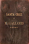
original cover
This map of southern Patagonia (Argentina and Chile) shows an early stage in the region's development, when much of the land was still vacant. Unsurprisingly, the best areas were already taken.
The original sheet has been cut into 56 segments. These segments, in turn, have been glued to a fabric backing, folded and protected with a stiff cover.
Lands are presented colour-coded, as owned, rented or public. Additionally, in the bottom-left corner are the results of an auction of Chilean lands, conducted shortly before publication.
To explore the contents, simply click the segment you wish to enlarge. The coordinates we use here are: rows A-G, columns 1-8.
Thanks: Agnes Fell, Anita Nicol, Michael Saunders
Publisher: Wilkinson & Lefrançois, Bs. As.